Luxembourg Sandstone Layer
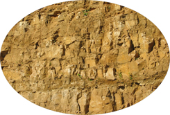
Luxembourg Sandstone layer
The Grünewald with its approximately 4500 ha, is situated on the Luxembourg Sandstone layer, an imposing rock of about 42 m thick, that had been formed 190 to 170 millions of years ago after the sedimentation of the sea.
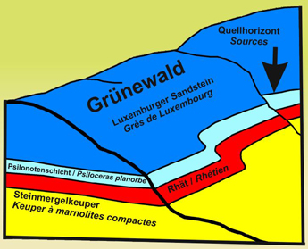
Geological profile
The sandstone is a porous and cracked rock, absorbing rain runoffs filtering through the forest soil to the lower ground layers. The Luxembourg Sandstone layer has become the most important national reservoir of drinking water, delivering about 90% of the drinking water of the phreatic groundwater in Luxembourg.
The rain runoffs are filtering through the permeable Sandstone layer down to the impervious Psiloceras layer, running off sideways at the intersection point with the surface ground, called then Layer source.
The protection role Grünewald for the drinking water
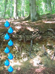 The Grünewald as well as all other forests, growing on the Luxembourg Sandstone layer have a special importance: they play a major protective role of the drinking water.
The rain runoffs are filtered through the different layers of the forest soil and the elements like dust or chemical pollution, which have been filtered out by this process are in a long term stocked in the ground. By this way the forest soil contributes largely to the cleaning process of the daily drinking water.
The springs of the Glaasburgronn
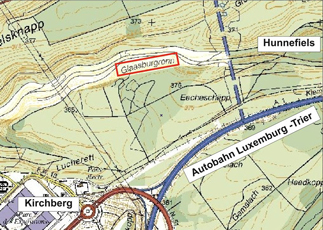
Numerous sources emerge from the earth in the cut and very tight valley of the Glaasburgronn
At Glaasburgronn, a v‑shaped valley situated on the edge of the Grünewald, many little springs have its source in the Luxembourg Sandstone layer. Flowing together they form a brook, flowing off westwards in the Alzette river in Dommeldange.
The water of the Glaasburgronn is of an excellent quality, proofed by the presence of all those animal species that are only able to live in clean waters (for example Stone flies larvae and planarians).
 Stone fly larva |
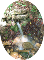 Emanation of a source out of the Luxembourg Sandstone layer at the Glaasburgronn |
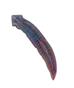 Planarian |
