The Luxembourg Sandstone layer, the most important ground water reserve in Luxembourg
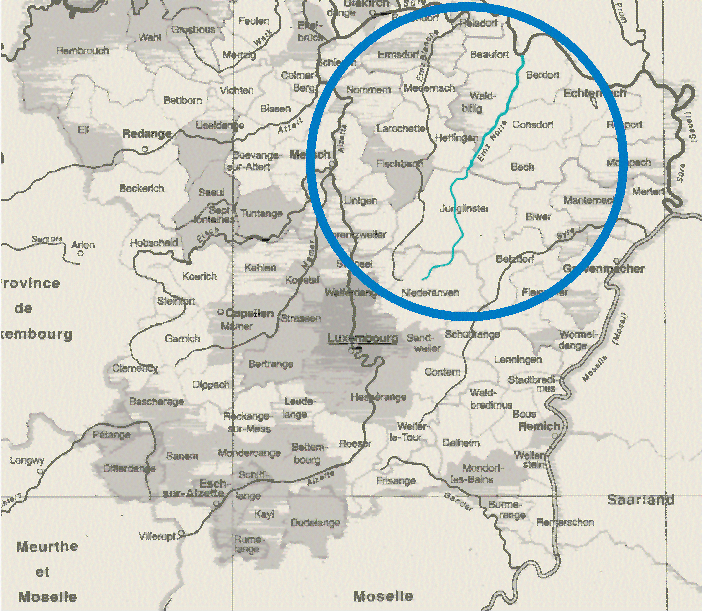
Near the border of the Grünewald, at the Westside of Ernster, the Black Ernz is rising. After then it is crossing on a distance of 20 km the north-east of Luxemburg, before flowing into the river Sauer near the Grundhof, a place located in the north-west of the town of Echternach. On its way it is crossing the famous landscape of the Müllertal, one of most beautiful region in Luxembourg.

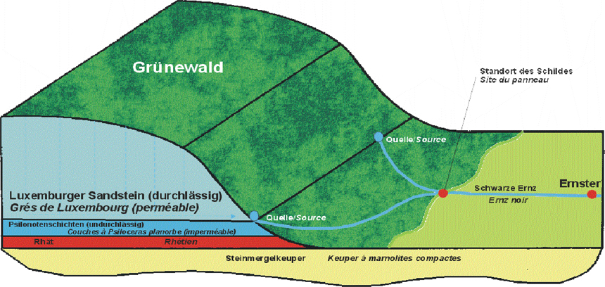
Geological section
Beginning of the rising
The springs of the Black Ernz are rising out from the Luxembourg sandstone plateau, which is most often covered with loose sand and woods, so that it is very spongy and rains can quickly enter the ground.

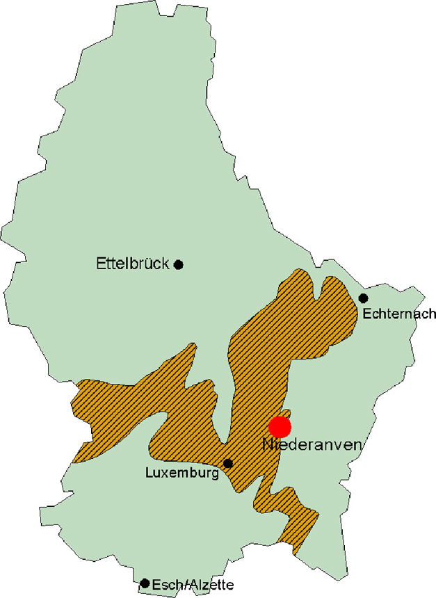
The extension of the Luxembourg sandstone layer
The rainwater is first entering the wood’s humus soil, which is playing a very protective role here by guaranteeing the water’s filtration. Then the waters are crossing the spongy sandstone, with a thickness up to nearly 42 m.
This Luxembourg sandstone is a perfect water carrier all because of its numerous cracks and porosity.
At the meeting point of this sandstone layer and the psiloceras planorbis layer (stony and non permeable layer) the water can no longer continue its way down and precisely on this point the springs are rising out.
The annual rain rate in Luxembourg is about 2 billion cubic metres from which 55% are evaporating, 41% flowing on the surface and only 4% can enter the soil to supply the ground water.

The Black Enrz as an element of the hydrography
Most of these 4% are entering the sandstone layer, spreading over 493 square km but from which only 300 square km are spongy enough to let the waters enter. The other 193 square km are covered by stony and chalky layers and can not play the filtering role.
The Luxembourg sandstone is supplying Luxembourg with up to 90% of drinking water emerging from ground waters (in Luxembourg 2 thirds of all the drinking water is coming from ground waters and one third from surface waters).
The forest ground, rich in humus is filtering the rain waters.
